WE SAT DOWN WITH AU’S DR. JAKE NELSON, AN ASSISTANT PROFESSOR IN THE COLLEGE OF SCIENCES AND MATHEMATICS DEPARTMENT OF GEOSCIENCES.
Tell us about your background and current position.
My background is somewhat interdisciplinary, spanning the natural and social sciences. While completing my B.S. and M.S. at Oregon State University in Environmental Science and Geography, respectively, I had the realization that many of the topics I was interested in studying had a strong policy component. That is, the social and environmental processes I was studying were the outcomes of specific policy decisions. This piqued my interest in policy studies and I became increasingly interested in understanding the impact that policies have on people and their interactions with the built and natural environment.
As a result, I completed my Ph.D. in Public Administration and Policy at Arizona State University. During that time, I focused on developing a more traditional policy analysis skill set in conjunction with my interests in spatial analysis and GIS. My background is part of the reason why I was interested in coming to Auburn and working in my current position which is an Assistant Professor in Geography with an emphasis on human-environment interaction. My current research focus is on the effects that extreme weather, climate change, and other hazardous events have on humans and their immediate environment, and how to better integrate the results of this (and other work) into policies that enhance community resilience.
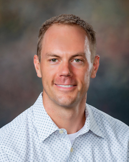
Dr. Jake Nelson of Auburn University’s College of Sciences and Mathematics.
Describe your current research activities.
My current research activities are about as broad and interdisciplinary as my background. One of my more mature projects aims to capture information about the built environment to remotely estimate patterns of social resilience. Using remote sensing and GIS techniques we are able to show that areas rich in what we refer to as “social infrastructure” have higher levels of social cohesion and overall sociality among community members. We believe that the presence of this type of infrastructure and the social outcomes it facilitates leads to heightened resilience during trying times. The next phase of the project will be testing whether this hypothesis is true.
I am also actively exploring the benefit of utilizing drones for data collection and analysis of the built and natural environment. For example, one of my current projects is evaluating the efficacy of using multispectral drone data to identify plant species that have unique pollen signatures. As another example, I am exploring ways that drones can be used to enhance our understanding of the local effects of climate-change related extreme weather events such as flooding and urban heat islands. I have several projects that are looking at how urban form can make localized flooding worse, and how greenspace and other natural amenities can be used to mitigate flooding. I also have several upcoming projects which include the AWRRI grant project and other work that centers on enhancing our collective understanding of ground water use, management, and potential for contamination.
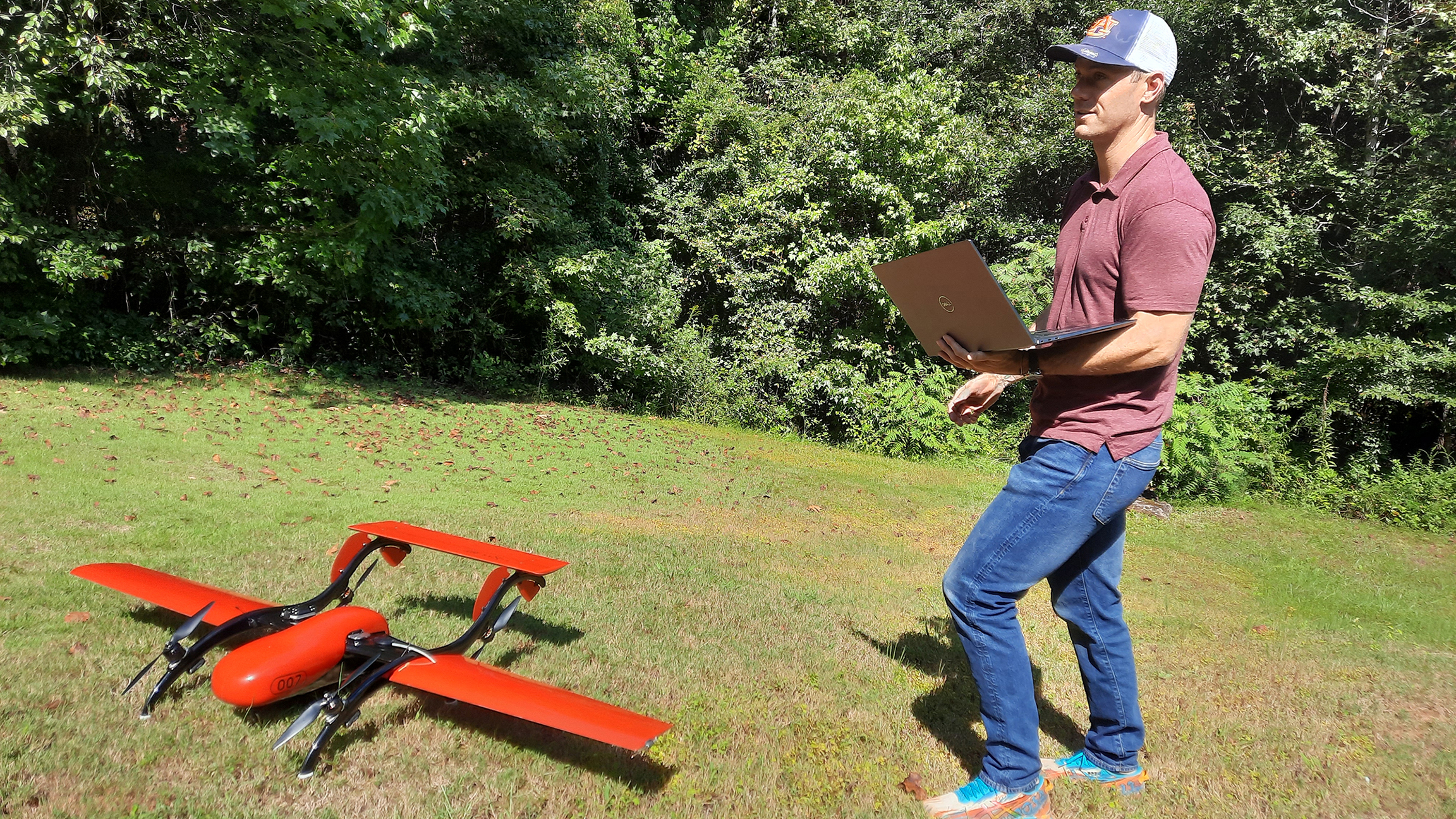
Drone Field Work. Photo Credit: Jake Nelson
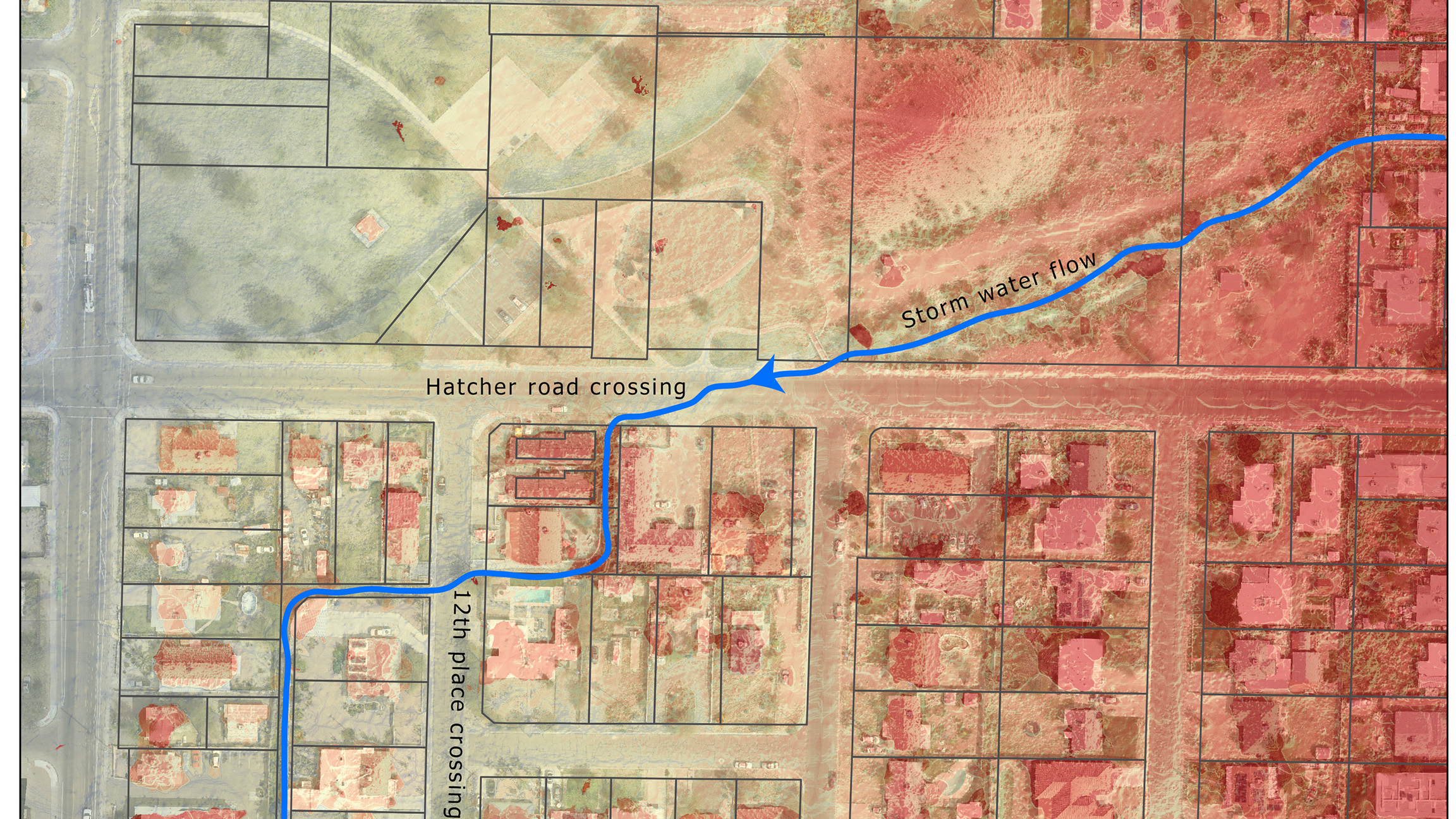
Drone overview of the primary route of the stormwater. Credit: Jake Nelson
Tell us your plans for your FY22 USGS Alabama Water Resources Research Institute (AWRRI) grant project.
I am really excited about the AWRRI grant project. This project is focused on applying data and spatial science methods to help identify domestic well owner communities at risk of drinking water contamination from bacteria such as E. coli. Many contaminants do not change the taste, sight, or smell of drinking water which makes regular testing and maintenance paramount in ensuring that it is clean and safe to consume. However, for some households, particularly those that are low income, the cost associated with well testing and maintenance may prevent them from regularly having their water checked. Moreover, there are known sources of domestic well contaminants in the environment and having one’s well in relatively close spatial proximity to those contamination sources has been shown to increase the probability for contamination. Of course, this wouldn’t necessarily be a problem if private drinking wells were federally regulated like public supplies, which are constantly monitored. But private wells are not. Thus, the onus of ensuring clean drinking water falls on the homeowner. The goal of this project is to determine where social vulnerability and domestic well contamination risk factors overlap so that we can help raise awareness about good well stewardship and access to well water testing opportunities.
I will be working with my colleagues Dr. Ann Ojeda and Dr. Stephanie Rogers in Geosciences to build a deeper understanding of who the Alabama domestic well owner community consists of, their socio-economic characteristics, and where households dependent on domestic wells may be at heightened risk of contamination from the surrounding environment. A large portion of this project is dedicated to collating disparate data sources into a spatial model of well contamination risk and social vulnerability. Our hope is that the results of this project, and the associated data and methodology can serve as a guide for targeted well water sampling campaigns or outreach events that build awareness among well owners who are most vulnerable and at risk of contamination.
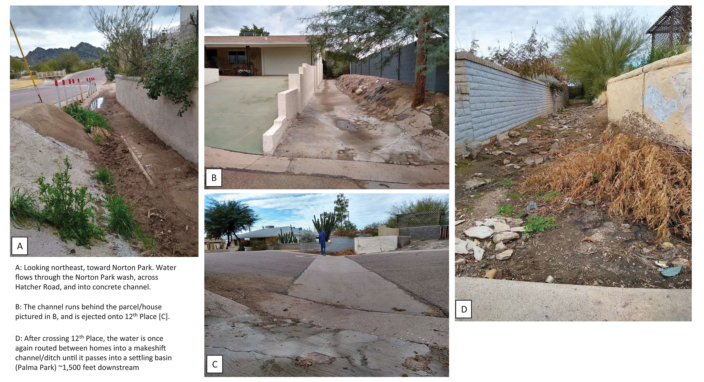
A series of photos tracking the flow of stormwater through several unofficial stormwater channels in Phoenix, AZ. Photo Credits: Jake Nelson
In your career, what is the best advice you’ve been given?
Oddly enough, the best career advice that I have ever received came from my batting coach while playing baseball in High School. One day after struggling with hitting the outside pitch, he told me “Get great at what you are good at, and the rest will follow.” While he said this to me in the context of playing baseball, it has been something I have found to be true throughout my professional career.
Honing a particular skill or quality that you already have some success in is often easier and more rewarding than doing something that doesn’t come as easily. For me, when I first began taking college level statistics, I absolutely hated it. The problem was, I needed it for my degree but just couldn’t quite figure it out. What I was good at, however, was GIS and spatial analysis. As I continued to get better at GIS and build my knowledge base, statistics began to creep back into my life due to the methods that I was getting more familiar with in GIS. By continuing to advance in GIS I came to understand statistics more and more. GIS was something that I was already good at and enjoyed doing, and by aiming to be great at it I eventually got pretty good at understanding and applying statistics. I am still no expert in statistics but have come to incorporate statistical methods into almost all my research projects.
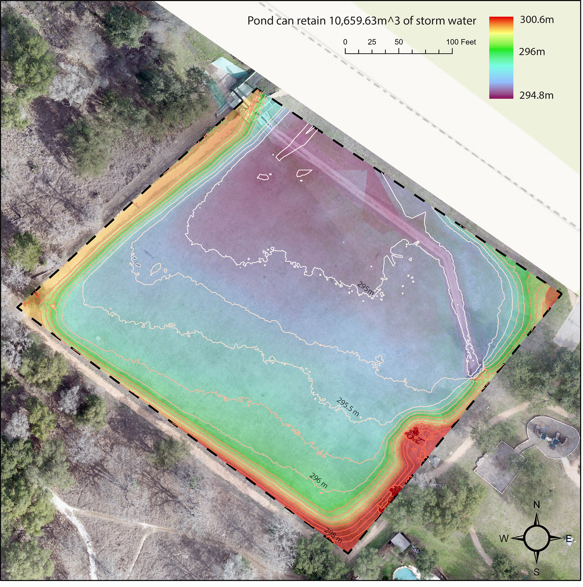
Volumetric calculations for retention pond using high resolution drone data. Photo Credit: Jake Nelson
