Written By: Laura Cooley, Jera Dills, Rachel McGuire and Sydney Zinner
The Alabama River is considered the heart river of the state. The Alabama is the state’s longest river, flowing for 315 miles and draining 22,800 square miles (11% of the state via 18 counties). The Alabama River is formed by the joining of the Coosa and Tallapoosa Rivers just north of Montgomery. The river begins at the Fall Line, an imaginary line demarcating the area of Alabama’s ancient coastline. The Alabama River then flows southwest from Montgomery, Alabama towards Selma, Alabama where the Cahaba River joins it. The river then continues south until it merges with the Tombigbee River to form the Mobile River near Mount Vernon, Alabama. The Alabama River watershed has a drainage area of 22,168 square miles.
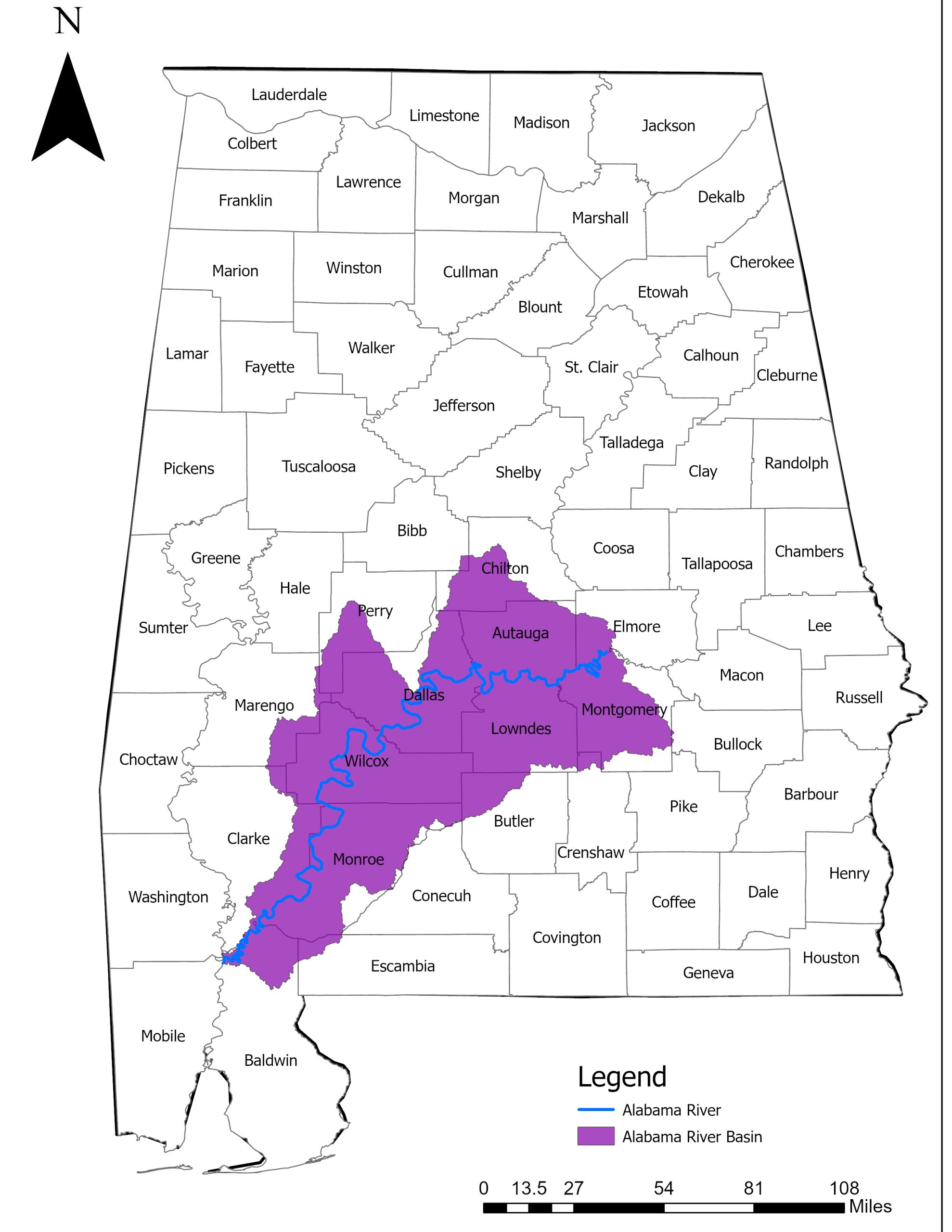
The Alabama River Watershed includes several counties in Alabama. Photo Credit: Cody Watson, ADEM Non-Point Source Unit
The Alabama River serves as the unifier of Alabama’s Eastern Rivers, the Coosa and Tallapoosa and the western rivers, the Cahaba, Black Warrior, and Tombigbee. Known for a wide variety of fish and wildlife, the Alabama River is a hotspot for many outdoor sports and activities.
The following counties are included in the watershed: Elmore, Montgomery, Chilton, Autauga, Dallas, Lowneds, Wilcox, Perry, Marengo, Monroe, Clarke, Escambia, and Baldwin.
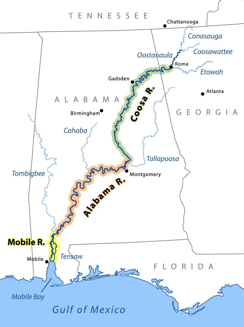
The Mobile, Alabama, and Coosa Rivers are a single river the name of which changes at the confluences of major tributaries. Credit: Wikimedia Commons

Alabama River Whale Vertebra held by Dr. Bill Deutsch. Photo Credit: Bill Deutsch
History
The state of Alabama, named after the Alabama River, originates from the Alabama Tribe. In the 18th century, the Alabama Tribe became part of the Creek Confederacy. After the French and Indian War, the tribe left Alabama, allied with the Coushatta Tribe, and the two tribes moved to east Texas in 1795. The Alabama-Coushatta reservation is currently the oldest reservation in Texas. However, one section of the tribe remained in Alabama and is now known as the Poarch Band of Creeks.
Free-flowing, or un-impounded, sections of the Alabama River contain many high bluffs that formed as the chalky soils of the Black Belt were carved away. Hatcher Bluff (estimated to be 350 feet high in 1925) along the Blackwell Bend of the main stem of the Alabama River near Sardis, Alabama.
Steamboats have been important in Alabama’s history. The first steamboat, named the Alabama, was launched in 1818 on the Alabama River. Steamboats allowed commerce to develop along navigable waters such as the Alabama River, encouraging development of towns such as Montgomery and Selma. Steamboats also made the cotton trade possible as well as increased its production. In the City of Prattville, north of Montgomery, the Daniel Pratt Cotton Gin Factory, sits next to Autauga Creek, a tributary to the Alabama River. The factory became the largest cotton gin machinery factory in the world and supplied cotton gins to all cotton producing countries in the mid 1800’s.
A 19th century steamboat replica called the The Harriot II Riverboat is docked in Montgomery’s Riverfront Park. Montgomery, known as the “Birthplace of Civil Rights,” has long been entwined in the history of Alabama.
View the Alabama Scenic River Trail website for suggested paddle guides on the Alabama River.
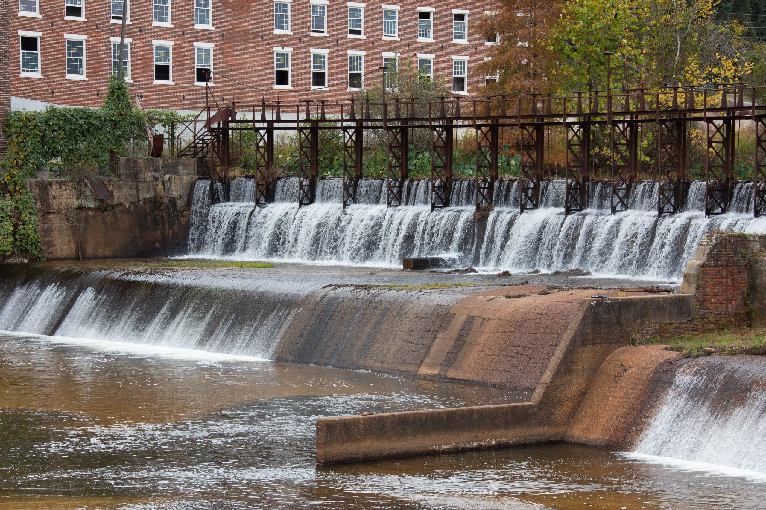
Autauga Creek at Pratt Cotton Gin Factory, Prattville, AL. Photo Credit: Jennifer Barker, ADEM Non-Point Source Unit
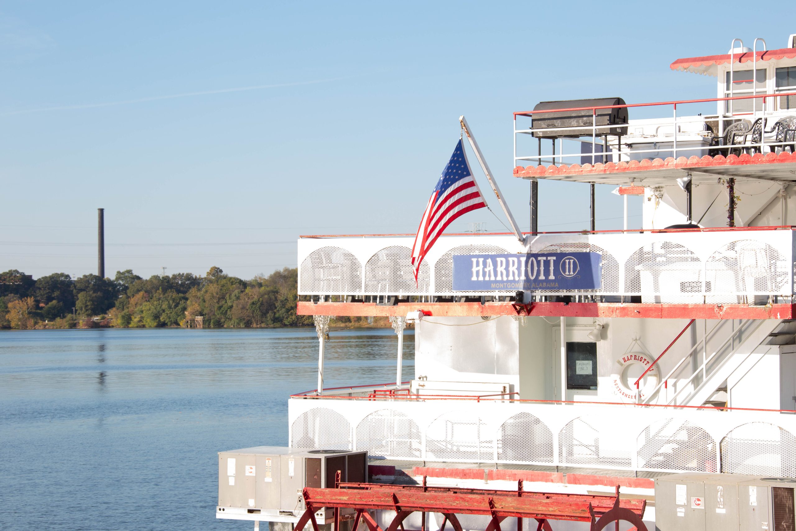
Harriot II Riverboat in the Alabama River, Montgomery, AL. Photo Credit: Jennifer Barker, ADEM Non-Point Source Unit
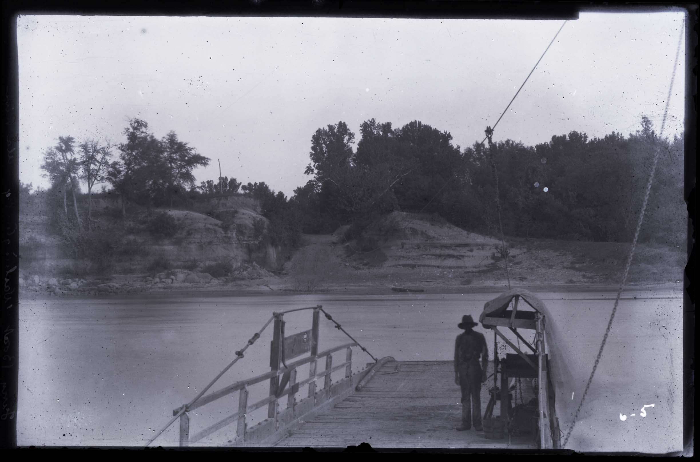
Ferry Boat on the Alabama River, 1894. Photo Courtesy of the University of Alabama Special Collections, Eugene Allen Smith Collection.
Notable Tributaries
The Cahaba River is the major tributary of the Alabama River. Its headwaters begin near Birmingham and meets the Alabama River in the former town, Cahaba of Dallas County. The Cahaba name is attributed to the Choctaw words oka meaning “water” and aba meaning “above”. The town of Cahaba was Alabama’s first seat of government from 1820 to 1825. The location for the government center was decided due to the area’s scenery, fertile soils, and navigable river. The Cahaba River is known for its abundantly diverse life, with more than 131 freshwater fish species, 40 mussel species, and 35 species of snails. The freshwater snail Elimia cahawbensis is named after the Cahaba and is endemic to this river system. In the early 2000s, 16 new species of flowering plants were discovered along the Cahaba that had not been sighted in the state of Alabama previously. The Cahaba Lily (Hymenocallis coronaria) is the most famous flowering species along the Cahaba due to its threatened status and the Cahaba being where three of the largest populations remain. Populations have dwindled due to dam construction preventing seeds from properly flowing to new lands to populate. Efforts to establish new populations are being undertaken in Columbus along the white-water course of the Chattahoochee River.
Autauga Creek is fundamental to the identity and development of Prattville as a thriving town. Autauga Creek runs through Prattville, Alabama, which is home to the Daniel Pratt Cotton Gin Factory, founded by the famous Alabamian Daniel Pratt in the 1830’s. The town of Prattville owes its name to Daniel Pratt, as it was named after him in 1839 due to how his influence fostered the advancement of the community. By 1860, The Daniel Pratt Cotton Gin Manufactory was the leading manufacturer of cotton gins in the world. Its success can be greatly attributed to its strategic creek-side location, which allowed for the use of hydroelectric power from the neighboring Autauga Creek Dam and facilitated the transportation of both products and materials throughout the state of Alabama.
Catoma Creek, near the city of Montgomery, is known for its famous excavation of fossils and artifacts that provide insight into the culture and daily life of communities in Alabama during the Middle Woodland period. The most famous fossil found is a Mastodon tooth discovered in 2005.
Notable Landmarks
The Edmund Pettus Bridge crosses the Alabama River in Selma, Alabama and was declared a National Historic Landmark in early 2013. This bridge is the site of what is known as Bloody Sunday, an incident of tragic police brutality following a civil rights movement march to the state capitol in Montgomery striving for equal voting rights.
Fort Jackson is a historic fort near the city of Wetumpka, near the headwaters of the Alabama River. This site was declared a National Historic Landmark in 1960 due to its role in the War of 1812. Following the Battle of Horseshoe Bend in 1814, Andrew Jackson initiated the construction of the fort. Later he declared the Treaty of Fort Jackson to the Northern and Southern Creek Native Americans which proclaimed 20,000,000 acres to be dedicated towards European settlement.
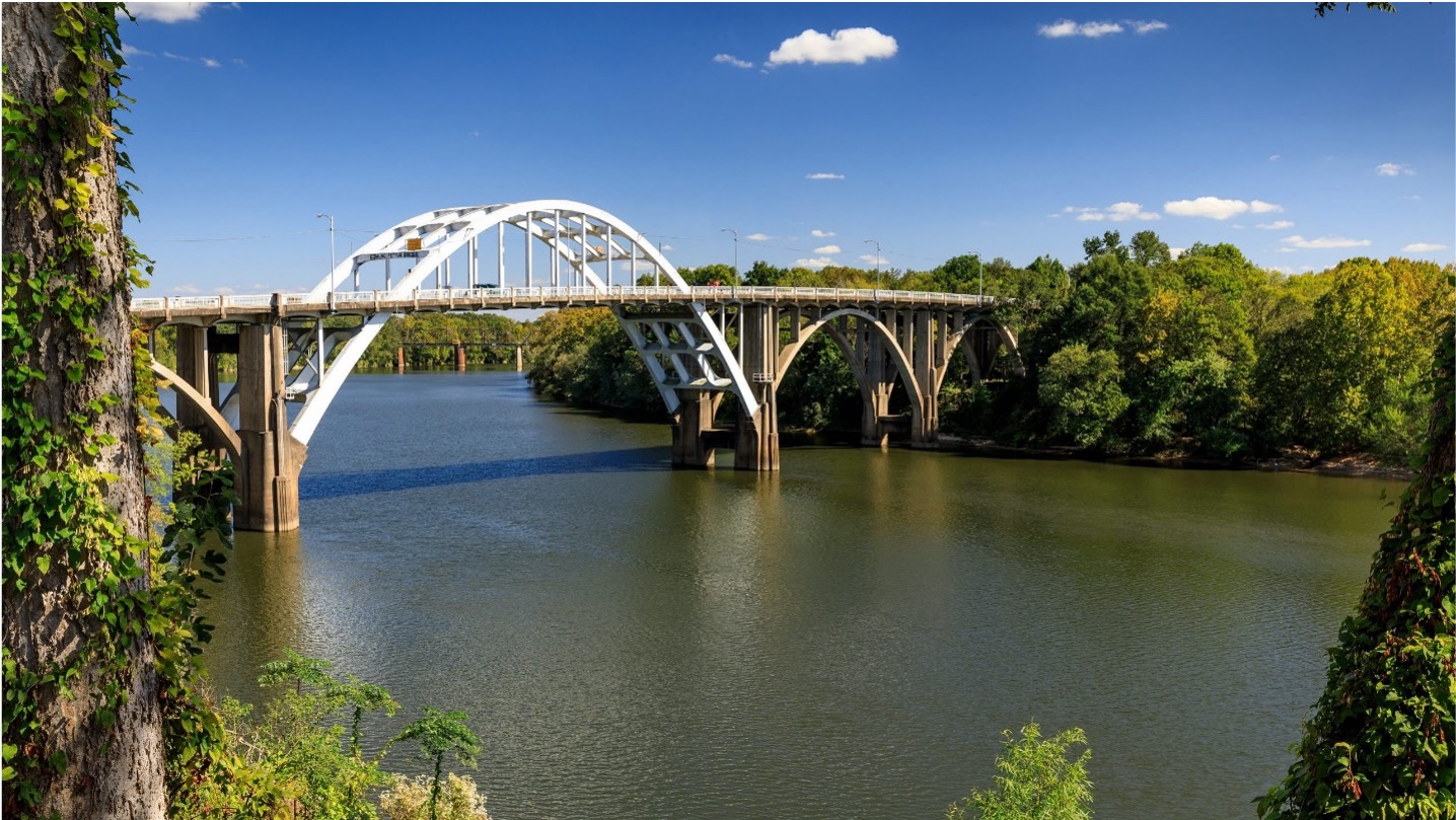
Edmund Pettus Bridge, Selma, Alabama. Photo Credit: Sergio Ruiz-Cordova, AUWRC
Dams
The Alabama River is impounded in three locations to form lakes: R.E. Woodruff Reservoir (aka Jones Bluff), William Dannelly Reservoir (aka Millers Ferry), and Claiborne Lake.
The construction of dams along the Alabama River was economically essential as transportation was not always feasible. Navigation would become restricted during low water levels of summer and fall, exposing shoals and sandbars leading to the development of three locks and dams at Robert F. Henry, Millers Ferry, and Claiborne. The development of these dams resulted in a nine-foot-deep channel spanning from Mobile to Wetumpka.
The Robert F. Henry Dam divides Autauga County and Lowndes County, constructed by the US Army Corps of Engineers in 1966. The dam was originally named Jones Bluff Dam but was renamed in late 1982. The construction of Robert F. Henry impounds the R. E. “Bob” Woodruff Reservoir in Montgomery. This was the first dam to be built along the Alabama River and it provided the use of hydroelectric power to nearby Montgomery. Read more about wildlife in the reservoir on the Outdoor Alabama website.
The Millers Ferry Dam is a hydroelectric dam near Millers Ferry, Alabama, constructed by the US Army Corps of Engineers in 1974. The dam impounds the William “Bill” Dannelly Reservoir. In 2009, the Corps of Engineers began opening the dam at select hours each day to allow migratory fish to travel to inland waters. Common fish spotted in this reservoir include white crappie, striped bass, hybrid striped bass, blue catfish, and channel catfish.
The Claiborne Lock and Dam encloses Clairborne Lake, which is considered by the most primitive river lake in Alabama. Nestled in Alabama’s southwest hill country, the lake encompasses over 60 miles of the Alabama River, stretching from the Claiborne Lock and Dam to Millers Ferry Lock and Dam. The dam was constructed by the US Army Corps of Engineers and was completed in 1971 but was opened for navigation purposes in 1969. In 2021 the Alabama Fish Passage Study was initiated to establish fish passage through the Claiborne dam in hopes to reconnect the Alabama River and the Cahaba to the Mobile River Delta.
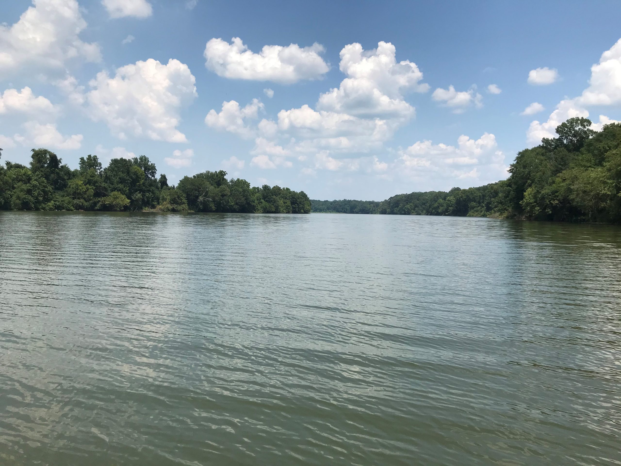
Claiborne Reservoir. Photo Credit: Mona Dominguez, AUWRC
Wildlife
The Alabama River watershed is home to giant spotted bass and largemouth bass near Jones Bluff, and largemouth bass and crappie near Millers Ferry. Claiborne Lake offers fishing for largemouth bass, crappie, bluegill, and catfish. The lower portion of the Alabama River contains alligator gar, paddlefish, Alabama darter, Alabama sturgeon, and is home to one of the richest freshwater mussel beds in Alabama,
Up to 144 species of fish have been documented from the Alabama river subbasin. Species of concern include the Blue Sucker, Alabama Shad, Southern Walleye, Paddlefish, Gulf Sturgeon, and the Alabama Sturgeon. The Alabama Sturgeon and several important mussel species rely on the stretch of river below Claiborne Lock and Dam which is the last, largely unregulated, big river habitat in Alabama.
The Alabama Sturgeon is of top protection concern throughout the Alabama river watershed. What once was one of the most concentrated fish species found in the Alabama river was last spotted in 2004. In recent years, traces of Alabama sturgeon DNA were found within the Alabama River, indicating the species’ presence. The cause for this drastic decline can be attributed to the blockages of dams along the entire river restricting fish passages. Restoration plans have begun being mapped to restore the Alabama’s natural flow by the combined efforts of the Geological Survey of Alabama, the Alabama Department of Conservation and natural Resources, the Alabama Department of Environmental Management, Alabama’s Office of Water Resources, and the United States Fish and Wildlife Service. The survey for feasibility of this project is proposed to be completed by the end of 2024.
The Red Hills Salamander is a large, terrestrial, burrowing, lungless salamander and is the sole member of the genus Phaeognathus. It was listed in 1977 under the Endangered Species Act as a federally threatened species. The Red Hills salamander is endemic to Alabama. The known range of the Red Hills salamander of approximately 60,000 acres of habitat is limited to the west by the Alabama River and to the east by the Conecuh River, within the Red Hills Region in portions of Conecuh, Covington, Crenshaw, Butler, Monroe and Wilcox counties.
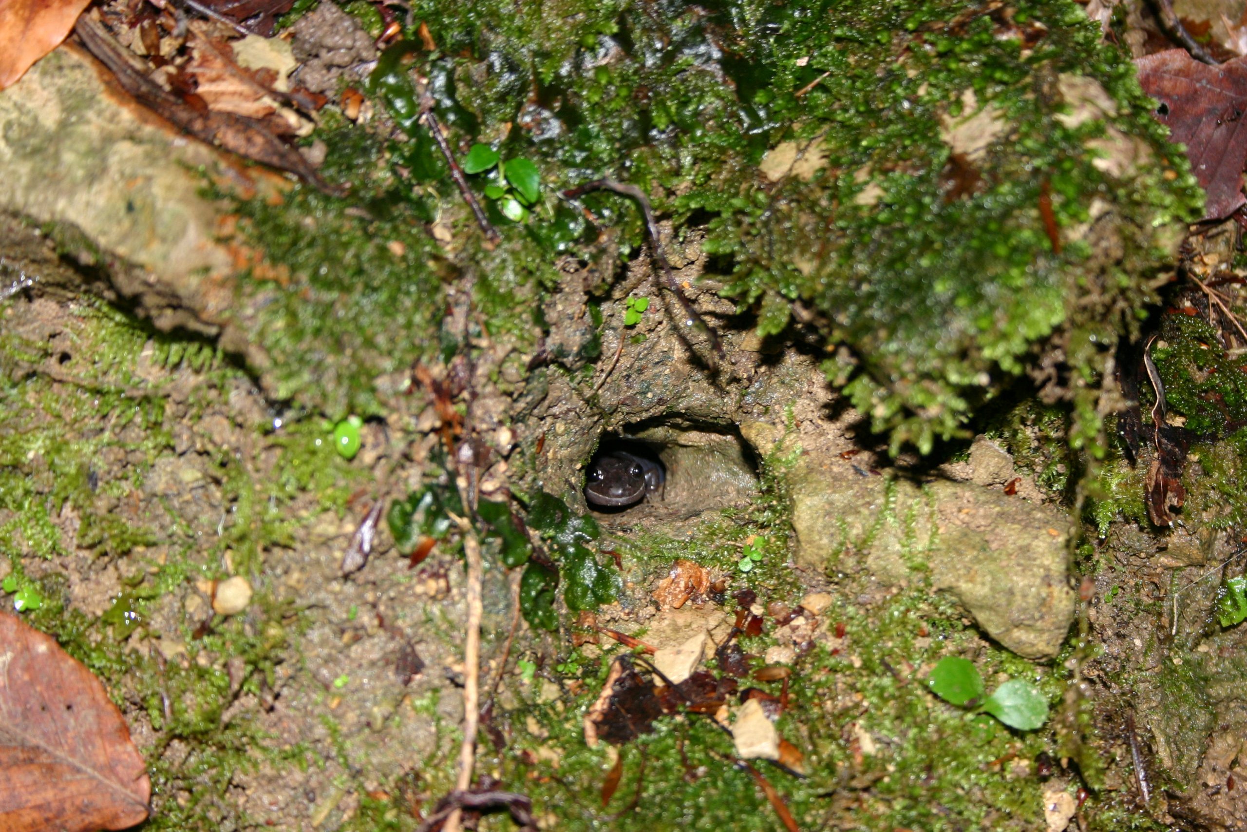
Red Hills Salamander Photo credit: Eric Soehren, ADCNR
Water Quality
On the Alabama Department of Environmental Management 2024 303(d) List of Impaired Waters, the Alabama River has 21 waterbodies listed as impaired. The most frequent impairment listed for the Alabama River reaches is pathogen pollution, with levels of concerning bacteria (E. coli) present in nine waterbodies. Five waterbodies are listed for metal impairments, specifically higher than average mercury levels. Four waterbodies are listed for siltation pollution, two for nutrient pollution, and one shows high levels of the pesticide, Dieldrin, which has an unknown source point. Sources of pollution include agriculture municipalities, urban development, pasture grazing, atmospheric deposition, on-site wastewater systems, aquaculture, agriculture, and collection system failures. Visit the Environmental Protection Agency’s How’s My Waterway website to see more information on tributaries to the Alabama River.

Alabama Department of Envirionmental Management’s 303(d) list of waterbodies in the Alabama River Watershed that are not meeting their water classification water quality standards.
References
Alabama Department of Environmental Management. (2024). 303(d) Information and Map. Water Programs. Retrieved from: https://adem.alabama.gov/programs/water/303d.cnt
Alabama Department of Environmental Management. (2023). Alabama River Basin. Trash Free Waters: Keep our Waters Clean. ADEM Non-Point Source Unit. Retrieved from: https://adem.alabama.gov/trashfreewaters/default.cnt
Deutsch, William G. (2018). Alabama Rivers: A Celebration and Change. MindBridge Press. DOI: 2018944968
How’s My Waterway? (2024). Unites States Environmental Protection Agency. Water Data and Tools. Retrieved from: https://www.epa.gov/waterdata/hows-my-waterway
Mellown, Robert O. (2008). Steamboats in Alabama. Encyclopedia of Alabama. Retrieved from: https://encyclopediaofalabama.org/article/steamboats-in-alabama/
US Army Corps of Engineers (2024). Alabama River Lakes. Retrieved from: https://www.sam.usace.army.mil/Missions/Civil-Works/Recreation/Alabama-River-Lakes/#:~:text=Claiborne%20Lake%20is%20the%20most,Millers%20Ferry%20Lock%20and%20Dam.
U.S. Fish and Wildlife Services. (2024). Red Hills Salamander. Retrieved from: https://www.fws.gov/species/red-hills-salamander-phaeognathus-hubrichti
